Loading…
Service Image

Transforming Data into Precision Insights

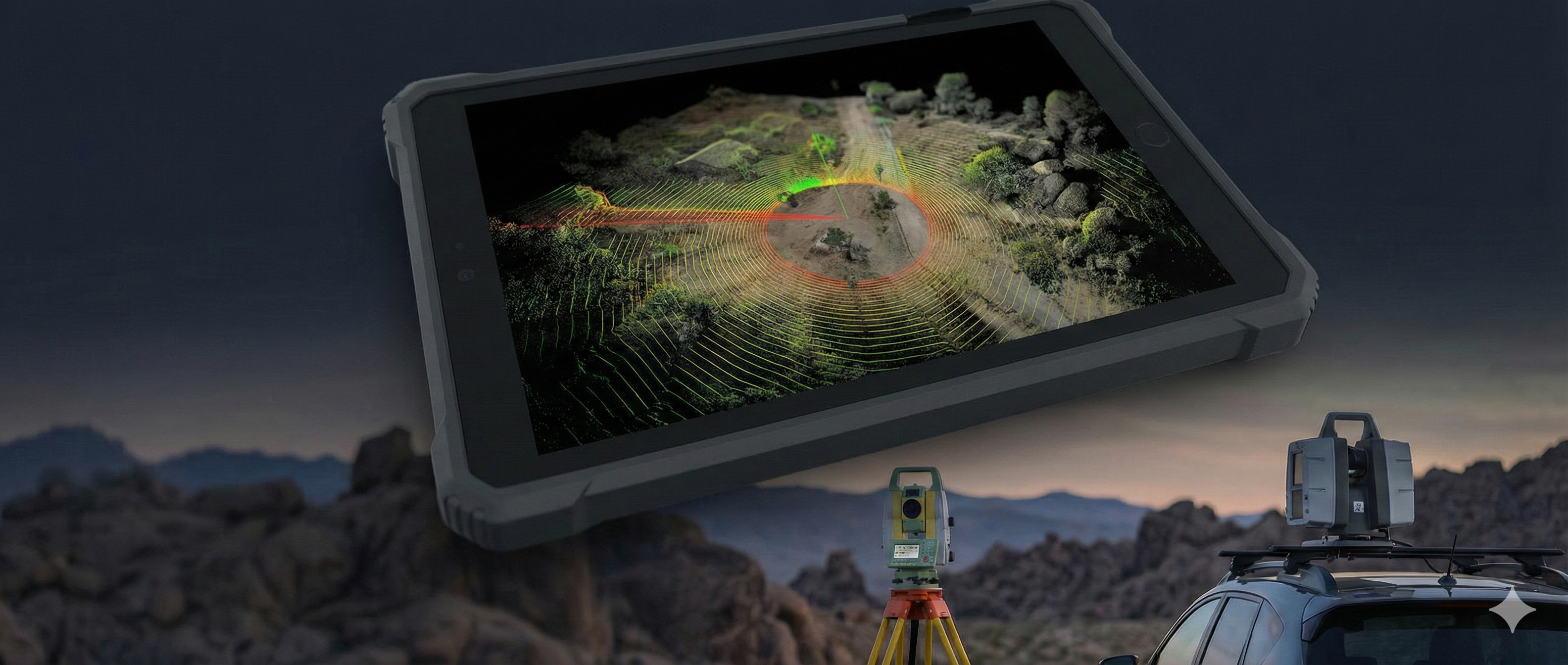
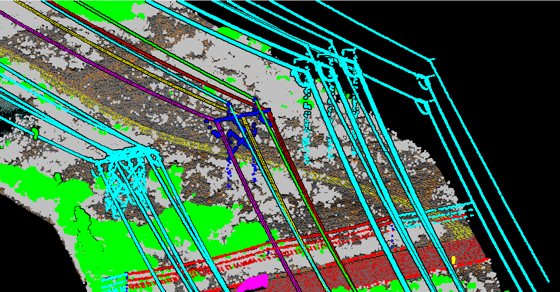
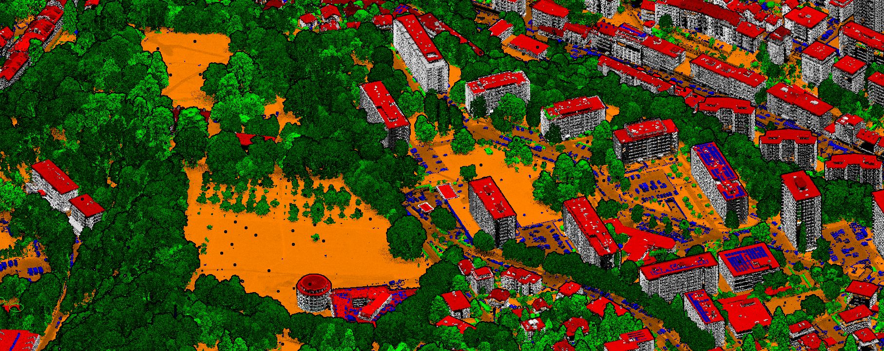
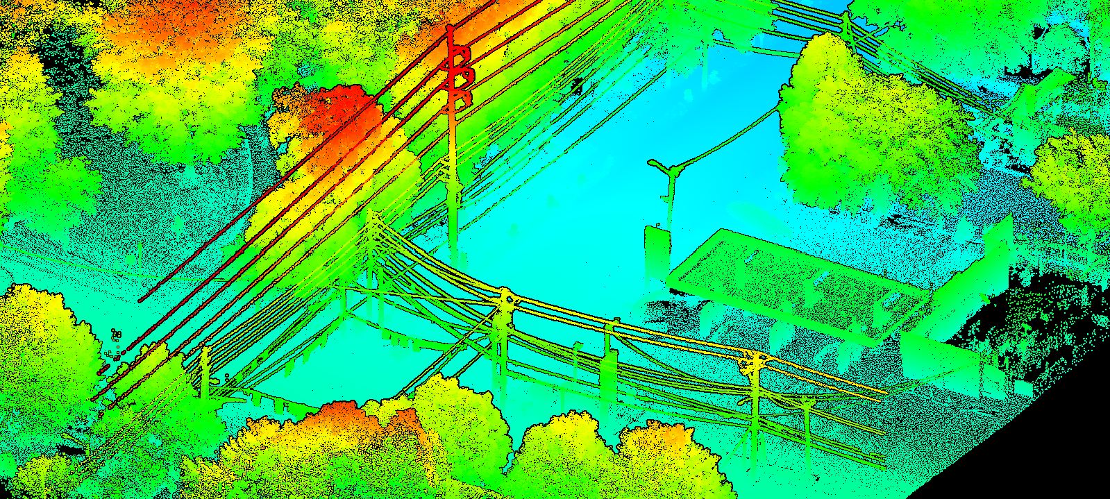
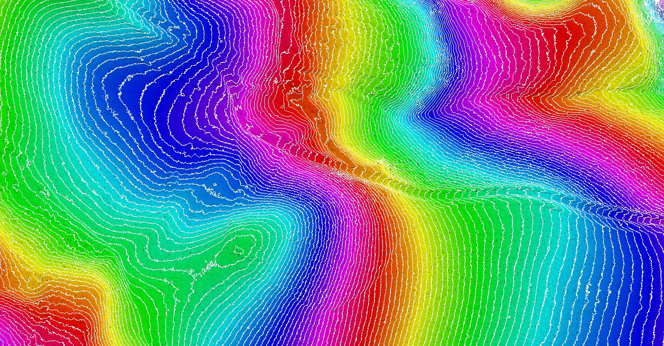
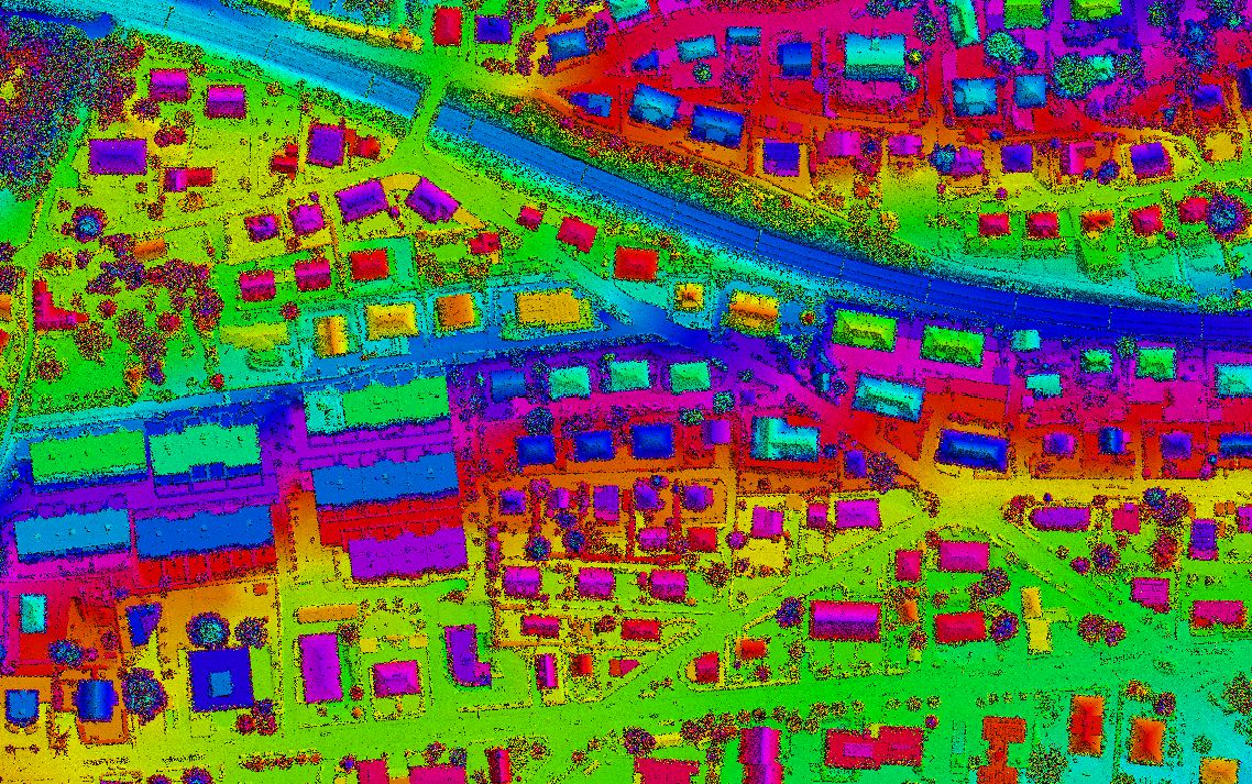
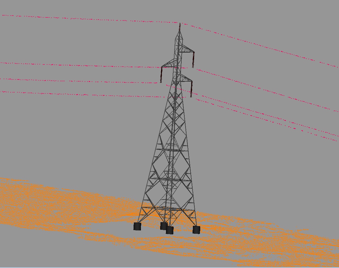
With a focus on creativity, innovation, and data-driven strategies, our LiDAR solutions empower industries with accurate and actionable geospatial data. At CODESCRIBO, we specialize in processing, classifying, and modeling LiDAR datasets to support applications in urban planning, environmental monitoring, and resource management. Partner with us to streamline your mapping workflow and achieve success in producing precise geo-content.

Let’s elevate mapping to the next dimension.

OUR What We Do

We help organizations implement and scale advanced Technologies through specialized services across:

  • Filtering of Point Clouds
  • Bare Earth and Non-Ground Classification
  • Building and Above Ground Feature Classification
  • Processing of Utilities (Power Line & 2D Mapping)
  • 2D/3D Vectorization
  • 3D Tower, Catenary, and POA Modeling
  • DTM / DSM / DEM Classification
  • Contour / Break Line & Spot Height Mapping
  • Technologies
Filtering of Point Clouds
  • Advanced filtering techniques to remove noise and irrelevant data from raw LiDAR point clouds.
  • Ensures enhanced data quality and improves subsequent classification and modeling accuracy.
Bare Earth and Non-Ground Classification
  • Separation of ground and non-ground points to generate accurate terrain models.
  • Essential for flood mapping, topographic analysis, and infrastructure planning.
Building and Above Ground Feature Classification
  • Identifying and classifying man-made structures and vegetation within LiDAR datasets.
  • Supports 3D modeling, asset management, and change detection workflows.
Processing of Utilities (Power Line & 2D Mapping)
  • Accurate extraction and modeling of powerline corridors and related infrastructure.
  • Enables efficient maintenance planning and network monitoring.
2D/3D Vectorization
  • Conversion of LiDAR point cloud data into precise 2D and 3D vector maps.
  • Enhances visualization and supports CAD and GIS integration.
3D Tower, Catenary, and POA Modeling
  • High-accuracy 3D modeling of transmission towers, catenaries, and points of attachment.
  • Essential for power network design, validation, and engineering simulations.
DTM / DSM / DEM Classification
  • Generation and classification of Digital Terrain Models (DTM), Digital Surface Models (DSM), and Digital Elevation Models (DEM) from LiDAR data.
  • Used for flood modeling, infrastructure development, and topographic analysis.
Contour / Break Line & Spot Height Mapping
  • Creation of contours, break lines, and spot height features for detailed topographic representation.
  • Supports civil engineering, land development, and terrain visualization projects.
Here’s a comprehensive list of the AI tools, frameworks, and technologies we specialize in.
3ds-max
AutoCAD
autodesk-revit
autodesk
blender
bricscad
mbs
sketchup
claude
apache-spark
dbt
enscape

OUR OFFERINGS

We generate high-accuracy 3D digital twins of wireless towers, rooftops, and surrounding radio environments to improve RF planning, structural reviews, and deployment accuracy.

Filtering of Point Clouds

We capture and maintain complete wireless asset inventories, including antennas, RRUs, cables, power units, and small cells—ensuring real-time visibility, optimized audits, and accurate field reporting.

Bare Earth and Non-Ground Classification

We map antenna placements, RRH locations, azimuths, tilt angles, and mounting heights to create precise tower layouts that support RF optimization and upgrade planning.

Building and Above Ground Feature Classification

We analyze mount load capacity, equipment weight, wind impact, and structural behavior to validate wireless antenna installations and ensure safe, compliant tower usage.

Processing of Utilities (Power Line & 2D Mapping)

We document field-installed wireless equipment, cable runs, GPS locations, and configuration changes, ensuring accurate site records for operations, audits, and future expansions.

2D/3D Vectorization

We assess structural integrity, load-bearing capacity, and equipment weight limits using engineering models to support new antenna additions, upgrades, and compliance checks.

3D Tower, Catenary, and POA Modeling

We assess structural integrity, load-bearing capacity, and equipment weight limits using engineering models to support new antenna additions, upgrades, and compliance checks.

DTM / DSM / DEM Classification

We assess structural integrity, load-bearing capacity, and equipment weight limits using engineering models to support new antenna additions, upgrades, and compliance checks.

Contour / Break Line & Spot Height Mapping

Industries We Serve

  • Construction & Infrastructure – High-precision LiDAR mapping for site surveys, terrain modeling, corridor mapping, construction monitoring, and volumetric analysis to support infrastructure development and project planning.
  • Urban Planning & Smart Cities – Advanced LiDAR data processing for 3D city modeling, digital twins, urban infrastructure analysis, and smart city planning with highly accurate elevation and structural data.
  • Mining & Quarrying – Accurate stockpile measurement, terrain modeling, slope stability monitoring, and operational analysis using drone and airborne LiDAR mapping technologies.
  • Agriculture & Environmental Monitoring – LiDAR-based terrain mapping, vegetation analysis, forestry assessment, watershed mapping, and environmental monitoring to support sustainable land management.

Why CodeScribo LiDAR Services?

  • End-to-End LiDAR & Geospatial Solutions – Comprehensive services including LiDAR point cloud processing, classification, 3D modeling, terrain extraction, and GIS data integration.
  • High Precision & Data Reliability – Delivering accurate spatial intelligence through advanced LiDAR processing techniques and strict quality validation.
  • Standards-Based Workflow – Adhering to international geospatial and LiDAR data standards to ensure consistency, interoperability, and compliance across projects.
  • Advanced Technology Ecosystem – Leveraging industry-leading LiDAR processing software, GIS platforms, and remote sensing tools for scalable and efficient geospatial workflows.
  • Dedicated Project Support – Providing continuous support for LiDAR data updates, geospatial database management, and large-scale project execution with strict delivery timelines.

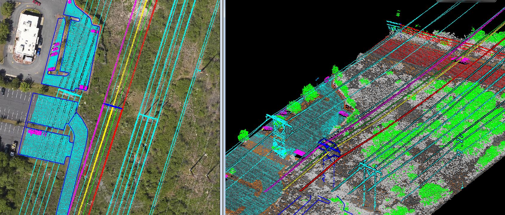
Client Highlights – LiDAR & Geospatial Expertise

  • Large-Scale LiDAR Data Processing – Delivered high-resolution geospatial datasets through advanced LiDAR point cloud processing, including classification, filtering, and generation of accurate terrain and surface models.
  • Digital Terrain & Surface Modeling – Generated Digital Terrain Models (DTM), Digital Surface Models (DSM), and contour datasets to support infrastructure planning, land development, and environmental assessments.
  • 3D Modeling & Spatial Intelligence – Developed detailed 3D terrain and infrastructure models using LiDAR data for engineering analysis, urban planning, and asset management.
  • Advanced Feature Extraction – Performed automated and manual extraction of buildings, powerlines, vegetation, and ground features from LiDAR point clouds, enabling accurate GIS integration and spatial analysis.
  • Quality Assurance & Data Accuracy – Implemented rigorous validation and quality control processes to ensure high-precision LiDAR outputs aligned with industry standards and project specifications.
  • Scalable Geospatial Program Delivery – Supported large-scale LiDAR mapping initiatives with optimized workflows, ensuring consistent data quality, efficient processing, and timely project delivery.

GET IN TOUCH

Call us, Email us or simply Send us a quick query using the form below...