Loading…
Service Image

Orthophoto

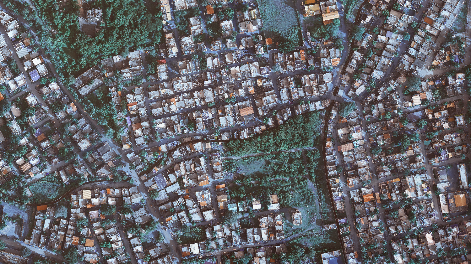
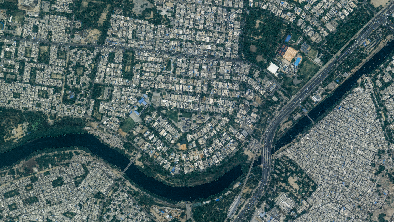
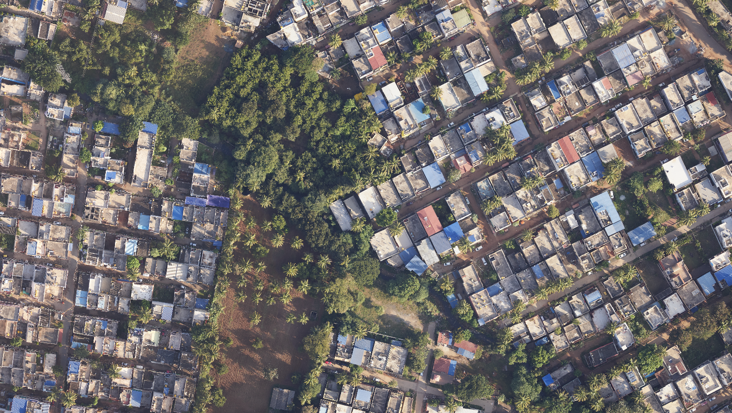
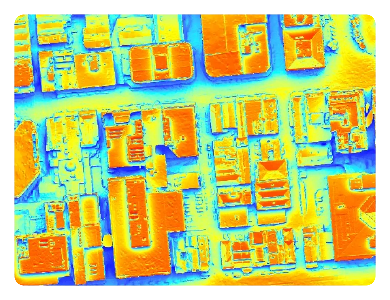
Orthophoto enables accurate calculation of planimetric distances, providing true-to-life representations of measured ground areas. CodesCribo demonstrates great expertise in providing Orthophoto services, which sets the base for multiple value-added services required for various client profiles.

OUR What We Do

We help organizations implement and scale advanced AI capabilities through specialized services across:

  • Orthorectification of Satellite Images
  • 3 Band and 4 Band Orthophoto
  • True Ortho
  • Thermal Orthophoto
  • Geo-referencing
  • Terra Orthophoto
  • Technologies
Orthorectification of Satellite Images
  • Correction of satellite images for topographic relief and sensor distortions.
  • Ensures geometrically accurate representation of the Earth's surface.
3 Band and 4 Band Orthophoto
  • Generation of multispectral orthophotos using 3 or 4 spectral bands.
  • Supports analysis for vegetation, land use, and environmental monitoring.
True Ortho
  • Production of orthophotos corrected for building lean and terrain distortions.
  • Ensures planimetrically accurate, visually realistic images for urban and rural areas.
Thermal Orthophoto
  • Generation of orthophotos from thermal imagery for heat mapping and energy analysis.
  • Supports infrastructure monitoring and environmental studies.
Geo-referencing
  • Assigning spatial coordinates to imagery to align with maps and GIS datasets.
  • Enables integration with existing spatial data for analysis and planning.
Terra Orthophoto
  • High-resolution orthophoto generation using terrestrial data sources.
  • Supports precise mapping, urban planning, and resource management.
Here’s a comprehensive list of the AI tools, frameworks, and technologies we specialize in.
TensorFlow
Twilio
Pytroch
OpenAi
N8n
Langchain
Apache-beam
cassandra
claude
apache-spark
dbt
gradio

Industries We Serve

  • Telecom Operators – Fiber network planning, deployment, and optimization
  • Engineering & Construction – High- and low-level design, permitting, and make-ready engineering
  • Utilities & Infrastructure – Pole load analysis, traffic control planning, and LiDAR mapping
  • Smart Cities & IoT – Network readiness, geospatial mapping, and FTTH rollout support

Why CodeScribo Telecom Services?

  • End-to-End Telecom Solutions – From network planning, high- & low-level design to deployment and maintenance
  • Accurate & Efficient Execution – Geospatial mapping, address validation, fiber network optimization, and permitting
  • Standards & Compliance – Adhering to NESC, G.O.095, CSA, and client-specific guidelines
  • Advanced Tools & Technology – Leveraging Katapult Pro, IKE Office, OCALC, and SPIDACALC for precise engineering
  • Reliable Project Support – Traffic control plans, pole analysis, make-ready engineering, and as-built updates

Client Highlights

  • FTTH Deployment: Successfully validated addresses and optimized fiber routes for multiple telecom operators.
  • Pole Load & Make-Ready: Conducted pole load assessments and engineered make-ready solutions ensuring regulatory compliance.
  • Network Planning: Designed high- and low-level network layouts using advanced geospatial and mapping tools to reduce deployment errors and costs.

GET IN TOUCH

Call us, Email us or simply Send us a quick query using the form below...