Loading…
Service Image

Precision Photogrammetry

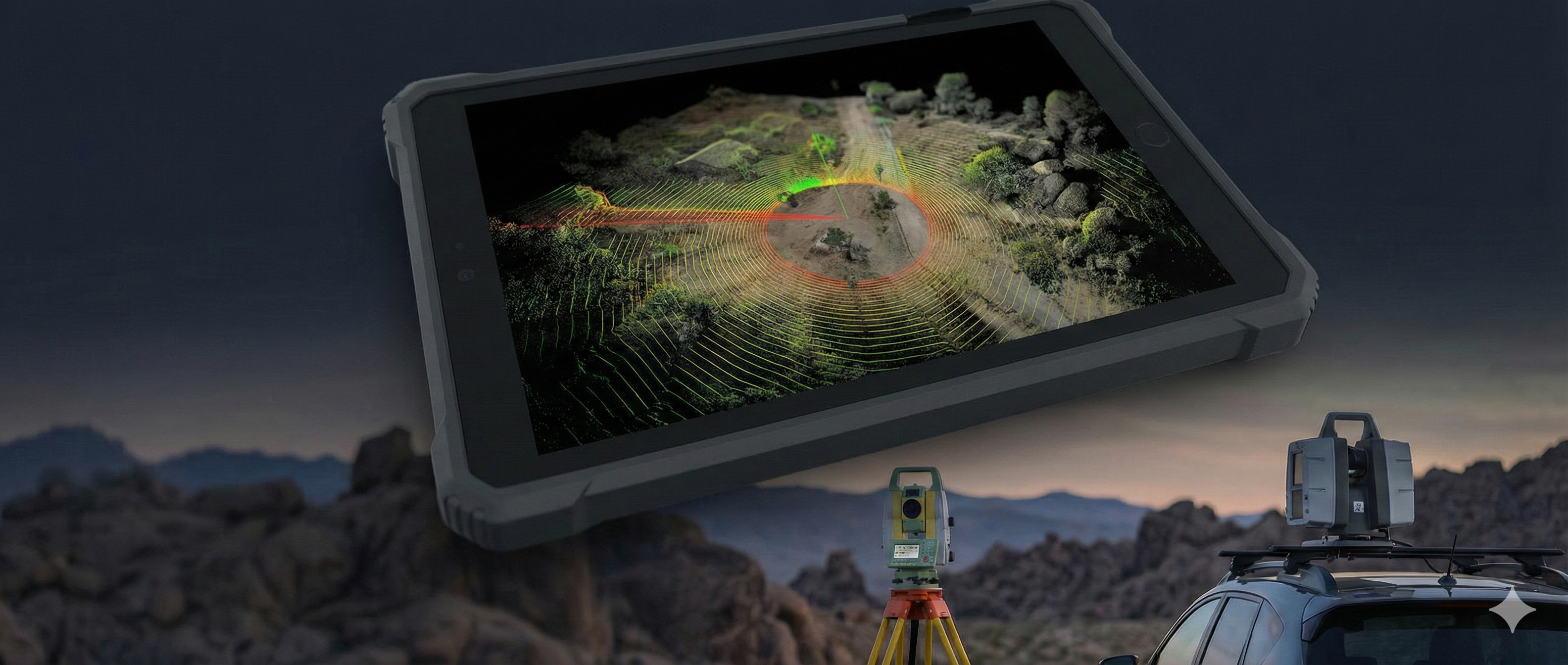
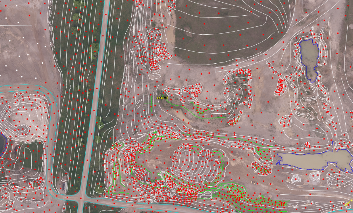
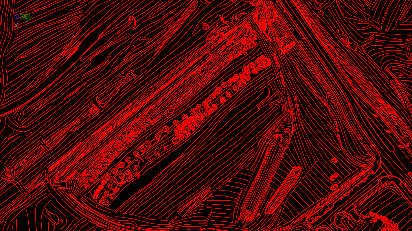
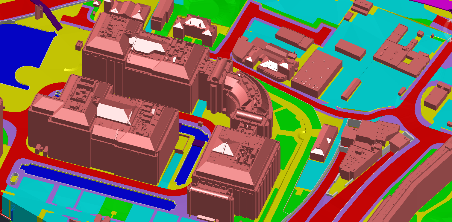
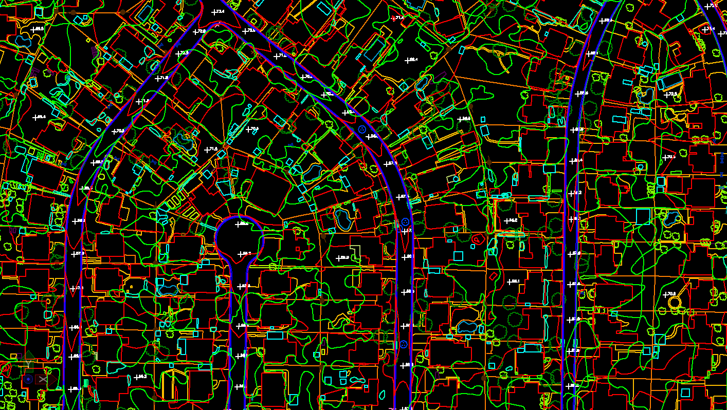
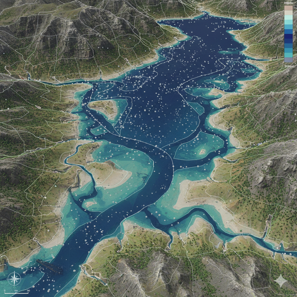
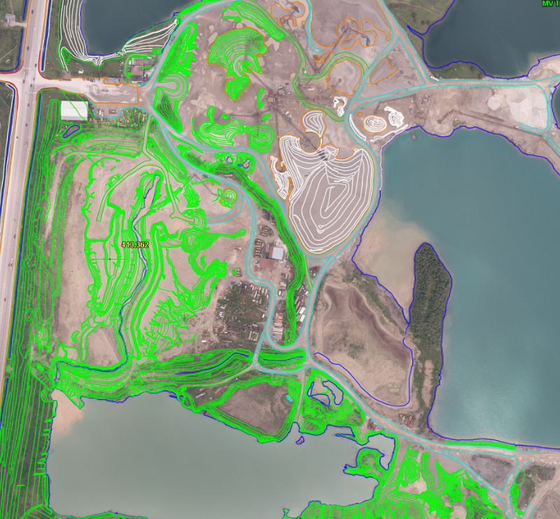
At CODESCRIBO, we specialize in delivering tailored Photogrammetry solutions, including aerial mapping, 3D modeling, and orthophotography generation — all designed to meet your unique needs. Our dedicated team of experts is committed to helping you achieve your goals and attain measurable results. Leveraging these diverse services, we're committed to delivering excellence every step of the way.

Let’s map the future together.

OUR What We Do

We help organizations implement and scale advanced AI capabilities through specialized services across:

  • Aerial Triangulation (AT)
  • Digital Elevation Models (DEMs)
  • Digital Terrain Models (DTMs)
  • Water Tight 3D City Modelling
  • Planimetric Mapping
  • Network Mapping
  • Volume Calculations & Contour Generation
  • 3D Feature Extraction / Elevations & Change Detection
  • Technologies
Aerial Triangulation (AT)
Establishing accurate ground control points and tie points to align aerial imagery.Ensures precise georeferencing and orientation for further photogrammetric processing.Improves overall mapping accuracy and spatial consistency.
Digital Elevation Models (DEMs)
Creation of detailed elevation data using mass points derived from stereo imagery or LiDAR.Used for terrain analysis, flood modeling, and infrastructure planning.Provides accurate surface representation for geospatial applications
Digital Terrain Models (DTMs)
Represents the bare-earth surface excluding buildings and vegetation.Essential for hydrological studies, slope analysis, and contour generation.Generated from LiDAR or photogrammetric data with precision filtering.
Water Tight 3D City Modelling
Development of high-resolution 3D city models with water-tight geometries.Supports urban planning, visualization, and simulation applications.Enables realistic rendering for digital twins and smart city initiatives.
Planimetric Mapping
Extraction of 2D map features such as roads, buildings, and vegetation outlines.Ensures high positional accuracy suitable for GIS integration.Ideal for cadastral mapping, infrastructure planning, and asset management.
Network Mapping
Creation of detailed geospatial network layouts including telecom, utility, and transportation systems.Supports efficient asset tracking and maintenance planning.Enhances spatial analysis and decision-making.
Volume Calculations & Contour Generation
Accurate measurement of cut and fill volumes for mining, construction, and land development projects.Generation of contour lines at customizable intervals for terrain visualization.Improves project estimation and topographic analysis accuracy.
3D Feature Extraction / Elevations & Change Detection
Automated and manual extraction of 3D features from stereo imagery or LiDAR datasets.Detection of temporal changes in terrain, structures, or vegetation.Ideal for monitoring infrastructure, environmental impact, and land use changes.
Here’s a comprehensive list of the AI tools, frameworks, and technologies we specialize in.
TensorFlow
Twilio
Pytroch
OpenAi
N8n
Langchain
Apache-beam
cassandra
claude
apache-spark
dbt
gradio

Industries We Serve

  • Telecom Operators – Fiber network planning, deployment, and optimization
  • Engineering & Construction – High- and low-level design, permitting, and make-ready engineering
  • Utilities & Infrastructure – Pole load analysis, traffic control planning, and LiDAR mapping
  • Smart Cities & IoT – Network readiness, geospatial mapping, and FTTH rollout support

Why CodeScribo Telecom Services?

  • End-to-End Telecom Solutions – From network planning, high- & low-level design to deployment and maintenance
  • Accurate & Efficient Execution – Geospatial mapping, address validation, fiber network optimization, and permitting
  • Standards & Compliance – Adhering to NESC, G.O.095, CSA, and client-specific guidelines
  • Advanced Tools & Technology – Leveraging Katapult Pro, IKE Office, OCALC, and SPIDACALC for precise engineering
  • Reliable Project Support – Traffic control plans, pole analysis, make-ready engineering, and as-built updates

Client Highlights

  • FTTH Deployment: Successfully validated addresses and optimized fiber routes for multiple telecom operators.
  • Pole Load & Make-Ready: Conducted pole load assessments and engineered make-ready solutions ensuring regulatory compliance.
  • Network Planning: Designed high- and low-level network layouts using advanced geospatial and mapping tools to reduce deployment errors and costs.

GET IN TOUCH

Call us, Email us or simply Send us a quick query using the form below...