Loading…
Service Image

Mobile Mapping

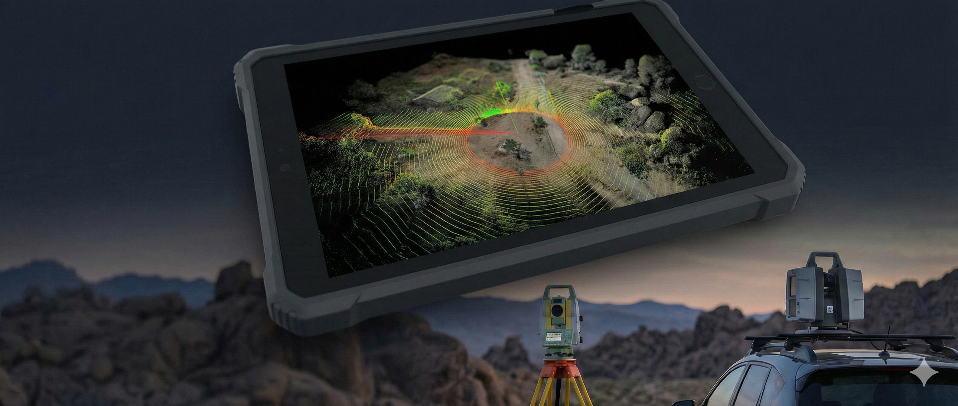
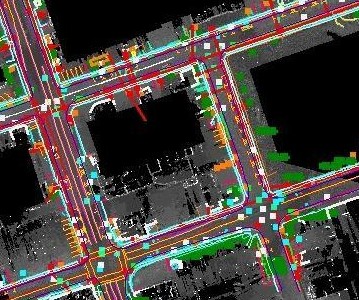
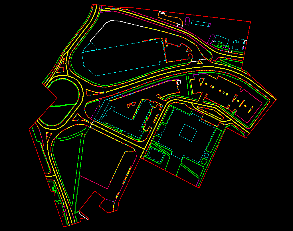
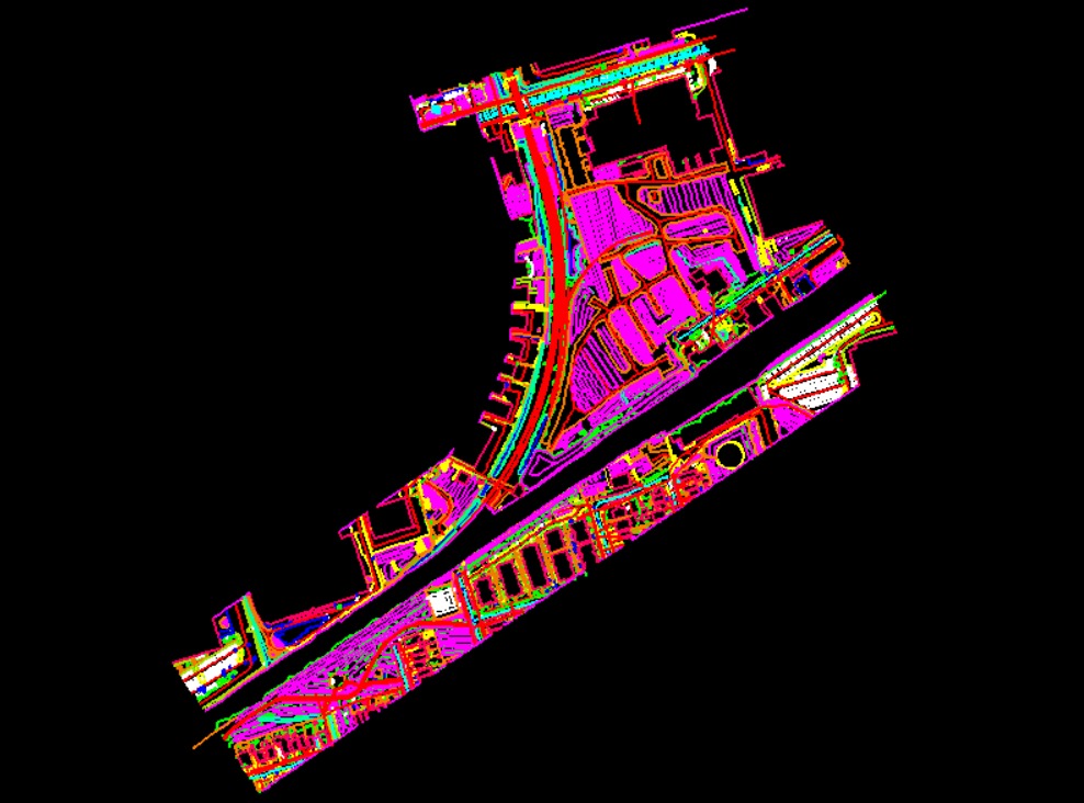
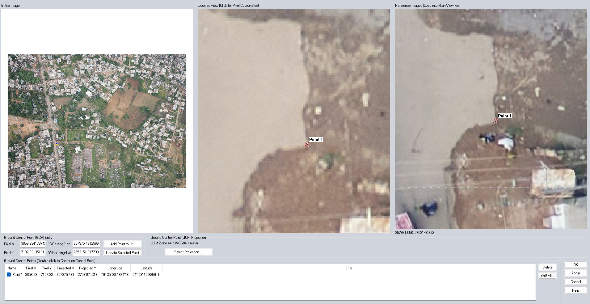
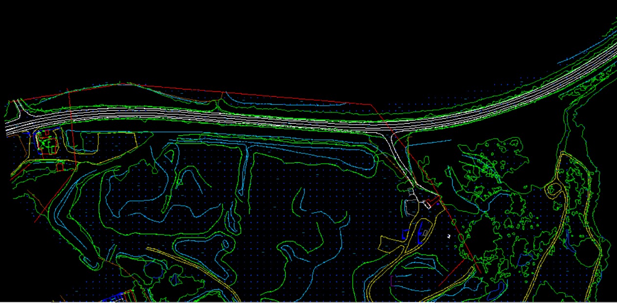
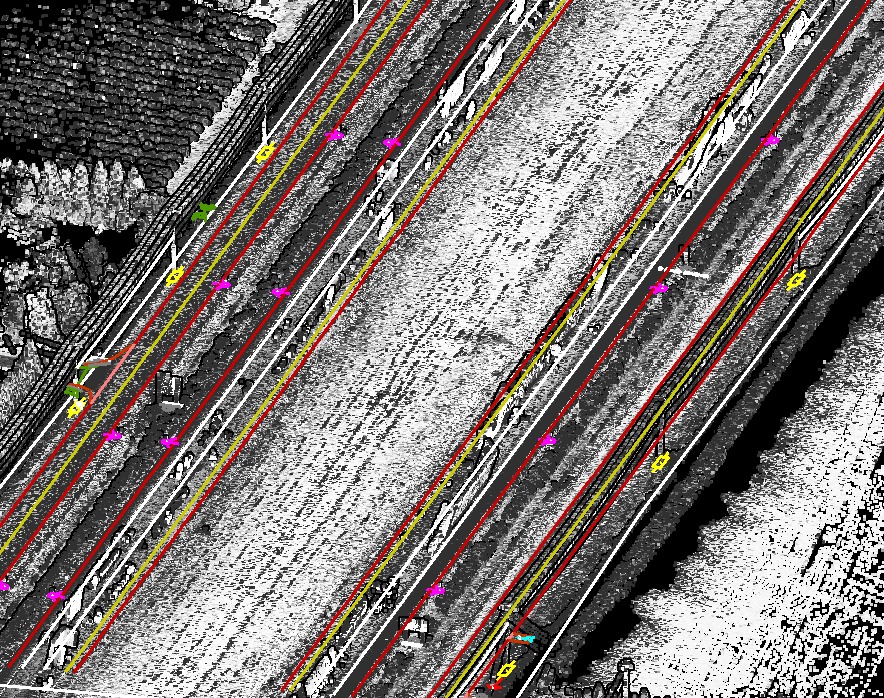
At CODESCRIBO, we overcome the limitations of static or terrestrial laser scanners through advanced Mobile Mapping technology. Our system enables high-density data capture at highway speeds, achieving centimeter-level accuracy and higher point cloud resolution than airborne laser platforms.

Our in-house engineers specialize in delivering detailed 3D mapping, comprehensive asset inventories, and precise geospatial models that exceed industry expectations.

OUR What We Do

We help organizations implement and scale advanced Technologies through specialized services across:

  • 3D Modeling & Visualization
  • Topographic Mapping
  • Railway Mapping
  • Corridor Mapping
  • Utility Mapping
  • Mining Mapping
  • Aerial Mapping
  • HD Mapping
  • Technologies
3D Modeling & Visualization
  • Creation of high-precision 3D models from mobile mapping data.
  • Supports visualization, simulations, and urban planning projects.
Topographic Mapping
  • Generation of detailed topographic maps using mobile mapping datasets.
  • Useful for land development, planning, and environmental studies.
Railway Mapping
  • Accurate mapping of railway tracks, corridors, and surrounding infrastructure.
  • Supports track maintenance, planning, and safety analysis.
Corridor Mapping
  • Mapping of linear infrastructure corridors including roads, pipelines, and railways.
  • Enables monitoring, asset management, and route optimization.
Utility Mapping
  • Mapping and modeling of utility networks including electricity, water, and gas pipelines.
  • Supports maintenance, planning, and infrastructure management.
Mining Mapping
  • Detailed mapping of mining sites and excavation areas using mobile LiDAR data.
  • Assists in volumetric calculations, safety planning, and resource management.
Aerial Mapping
  • Integration of aerial survey data for comprehensive mapping solutions.
  • Enhances 3D models, topographic mapping, and corridor analysis.
HD Mapping
  • Generation of high-definition maps suitable for autonomous vehicles and navigation systems.
  • Includes lane markings, road furniture, and traffic signs for accurate modeling.
Here’s a comprehensive list of the AI tools, frameworks, and technologies we specialize in.
3ds-max
AutoCAD
autodesk-revit
autodesk
blender
bricscad
mbs
sketchup
claude
apache-spark
dbt
enscape

OUR OFFERINGS

We create detailed 3D models and immersive visualizations of buildings, infrastructure, and terrain using advanced photogrammetry and LiDAR data to support planning, design validation, and decision-making.

3D Modeling & Visualization

We produce high-precision topographic maps that capture elevation, contours, terrain features, and natural landscapes to support engineering, land development, and infrastructure planning projects.

Topographic Mapping

We deliver accurate railway corridor mapping including tracks, signals, overhead equipment, and surrounding assets to support maintenance planning, expansion projects, and safety compliance.

Railway Mapping

We map transportation and utility corridors such as highways, pipelines, and transmission lines, providing detailed spatial data to support construction, inspection, and asset management.

Corridor Mapping

We identify and map underground and above-ground utilities including water lines, power cables, gas pipelines, and telecom networks to reduce risk and ensure safe excavation and development.

Utility Mapping

We provide precise mine site mapping and volumetric analysis for open-pit and underground operations, supporting resource estimation, safety monitoring, and operational planning.

Mining Mapping

We capture high-resolution aerial imagery and geospatial data using UAVs and aircraft to generate orthophotos, surface models, and mapping products for large-scale projects.

Aerial Mapping

We create high-definition maps with centimeter-level accuracy for smart cities, autonomous navigation, and advanced infrastructure management applications.

HD Mapping

Industries We Serve

  • Construction & Infrastructure – High-precision mobile LiDAR and imaging data capture for infrastructure corridors, highways, railways, and urban environments. Our mobile mapping solutions support asset inventory, corridor mapping, as-built documentation, and construction progress monitoring, enabling accurate planning and efficient project execution.
  • Urban Planning & Smart Cities – Advanced mobile mapping technology enables rapid collection of street-level geospatial data for 3D city modeling, urban infrastructure analysis, digital twin creation, and smart city planning. High-density point clouds and panoramic imagery provide accurate spatial datasets for modern urban development.
  • Transportation & Road Asset Management – Mobile mapping systems capture high-resolution LiDAR and imagery along road networks to support roadway inventory, pavement condition analysis, signage and road marking extraction, and transportation infrastructure monitoring.
  • Utilities & Infrastructure Asset Management – Accurate street-level mapping for power lines, telecom networks, pipelines, and urban utilities. Mobile mapping enables efficient asset inventory, inspection planning, and geospatial database creation for infrastructure management.
  • Mining & Industrial Facilities – Mobile LiDAR mapping supports site mapping, infrastructure monitoring, facility documentation, and terrain analysis in mining and industrial environments, improving operational planning and safety management.

Why CodeScribo Mobile Mapping Services?

  • End-to-End Mobile Mapping Solutions – Comprehensive services including mobile LiDAR processing, point cloud classification, feature extraction, GIS data creation, and infrastructure asset mapping.
  • High-Precision Street-Level Mapping – Delivering accurate geospatial datasets using advanced mobile LiDAR and imaging technologies for detailed infrastructure documentation.
  • Standards-Driven Geospatial Workflow – Following international geospatial and LiDAR processing standards to ensure reliable, consistent, and interoperable mapping outputs.
  • Advanced Geospatial Technology – Leveraging industry-leading LiDAR processing software, GIS platforms, and 3D mapping technologies for scalable mobile mapping projects.
  • Dedicated Project Support – Providing continuous support for data updates, asset database maintenance, and large-scale infrastructure mapping programs with strict delivery timelines.

Client Highlights – Mobile Mapping & Geospatial Expertise

  • Large-Scale Mobile Mapping Data Processing – Processed large-volume mobile LiDAR point cloud datasets and panoramic imagery captured from vehicle-mounted systems, ensuring efficient data handling and scalable geospatial production.

GET IN TOUCH

Call us, Email us or simply Send us a quick query using the form below...